Saturday, 20 November 2010
Log Entry 11-16-2010 1800hrs PST
11-16-2010 1800 hrs.
Position: 27 deg. 06.5 min. north, 114 deg. 35.3 min. west
Course: 105 deg. M
Speed: 5.8 kt
Wind: 13 kt @ NW
Sea: 4' swell @NW
Sky: 100% clear
Broad reaching under full main and #2. Early afternoon the wind built to 18-20kt and gave us a big push south. We are now headed southeast and will pass about 8 nm off Isla San Roque, then a few miles further, Isla Asuncion. There is a good anchorage in Bahia Asuncion, protected by the island. We won't stop there now but will when we come back this way next year.
Read More..
Position: 27 deg. 06.5 min. north, 114 deg. 35.3 min. west
Course: 105 deg. M
Speed: 5.8 kt
Wind: 13 kt @ NW
Sea: 4' swell @NW
Sky: 100% clear
Broad reaching under full main and #2. Early afternoon the wind built to 18-20kt and gave us a big push south. We are now headed southeast and will pass about 8 nm off Isla San Roque, then a few miles further, Isla Asuncion. There is a good anchorage in Bahia Asuncion, protected by the island. We won't stop there now but will when we come back this way next year.

Tuesday, 16 November 2010
Turtle Bay
We left Ensenada Friday morning, motoring in no wind. Our course took us southwest between Isla Todos Santos to starboard and Punta Banda, home of the famous La Bufadora, to port. Once clear of the island we caught a fifteen knot breeze out of the northwest and the Honcho headed south toward Isla Cedros, about 260 miles away. On the way we would pass well out to sea from San Quintin and the notorious Sacramento reef. Cedros lies at the southwest corner of the vast Bahia Vizcaino, just northwest of Punta Eugenia. The famous Scammons Lagoon is in the southeastern part of Bahia Vizcaino. The lagoon is a breeding and calving ground for Gray whales which migrate annually from the arctic sea. In the winter the place is teeming with whales and while spectacular, it is not a good place for a sailboat. Scammon's Lagoon got its name from captain Charles Scammon, who discovered this breeding ground in 1857 and was the first to harvest the gray whale for its oil. On many maps the bay is called Bahia de Ojo Liebre. Scammon and other whalers set up shop in the lagoon and over the next few decades nearly drove the grays to extinction. In fact, by 1900 they were thought to be extinct. Think of the David Crosby/Graham Nash song, "Wind on the Water". Fortunately the taking of grays was banned and their population has rebounded, and now thousands of them make the annual trek along the Pacific coast to breed and calve not only at Scammons but in many of the bays and inlets along the Baja coast and Sea of Cortez. We'll see lots of these animals as we cruise south from here.
Anyway, we passed about 60 miles out from Scammons lagoon, and to westward of Cedros Island and tiny San Benito Island as well. Turning southeast we rode a strong wind and rolling sea toward Turtle Bay, arriving at 2:00pm after sailing a distance of almost exactly 300 miles, taking a little more than two days. This place got its name for the large number of sea turtles that once used it for the same purpose as the Grays at Scammons, only the story ends differently. There are virtually no more turtles left in Turtle Bay.
Here in Bahia de Tortugas we took on fuel, had a nice lunch at Enrique's, wandered around the dusty town of 4,000 and generally lazed about for a couple of days. Rested and ready, we'll leave this afternoon for Bahia Santa Maria, 225 miles down the coast.
Read More..
Anyway, we passed about 60 miles out from Scammons lagoon, and to westward of Cedros Island and tiny San Benito Island as well. Turning southeast we rode a strong wind and rolling sea toward Turtle Bay, arriving at 2:00pm after sailing a distance of almost exactly 300 miles, taking a little more than two days. This place got its name for the large number of sea turtles that once used it for the same purpose as the Grays at Scammons, only the story ends differently. There are virtually no more turtles left in Turtle Bay.
Here in Bahia de Tortugas we took on fuel, had a nice lunch at Enrique's, wandered around the dusty town of 4,000 and generally lazed about for a couple of days. Rested and ready, we'll leave this afternoon for Bahia Santa Maria, 225 miles down the coast.
Thursday, 11 November 2010
Cruising boats of Ensenada
????
Read More..
 |
| A fine example of a luxury sailing yacht, about 65' long. Probably here to serve out its year out of the states to avoid taxes. This is by far the nicest sailboat in the harbor. |
 |
| I couldn't resist taking a photo of this Nordhavn 63. Also new and likely serving its year out of the States. Nordhavn's have a well deserved reputation as very capable long distance cruising motor yachts. |
Wednesday, 10 November 2010
Ensenada
Had a nice sail down from Long Beach. Mostly light air all the way. Got a bit of rain twenty miles out, but, all things considered it was a near perfect ride. Yesterday I wandered around the marina looking for interesting cruising boats to write about. Unfortunately there was only one to be seen, and I already know all about the Honcho. There are quite a few cruising sailboats here, but they all look like they've been here a long time and their owners have no plans to leave anytime in the foreseeable future. Both the boats and their owners look pretty old and kind of scruffy...I fit right in!
The weather forecast is for warm temps and fair winds, so the Honcho will be out of here in a couple of days.
Read More..
The weather forecast is for warm temps and fair winds, so the Honcho will be out of here in a couple of days.
Sunday, 31 October 2010
Catalina
Spent the weekend in Catalina, at Two Harbors. There was no wind on the 24 mile trip from Long Beach to the Island so we motored the entire way. On the way we ran the watermaker and topped up our starboard water tank, tested the autopilot, GPS, Maxsea software and other systems...all worked well. At Two Harbors we picked up a mooring in front of the village and made the boat all snug, as we expected some weather later. A fast moving cold front passed through overnight, bringing wind and rain from around midnight to dawn, and left us with a cold northerly wind the next morning. We hiked over to Cat Harbor around midday to enjoy the scenery of that idyllic anchorage. It's a short hike across the narrow isthmus, to the southwest side of the island where Cat Harbor is located. On the way we came across two bison grazing in the field next to the road. Bison roam wild on Catalina. They were originally brought over from the mainland in 1924 for the filming of a Zane Grey silent western. Since then, the Catalina Island bison herd has been carefully nurtured and controlled by the Island Conservancy, and number about 150 head. Shaggy and prehistoric looking, they are the undesputed kings of the animal life on the island, except for us humans.
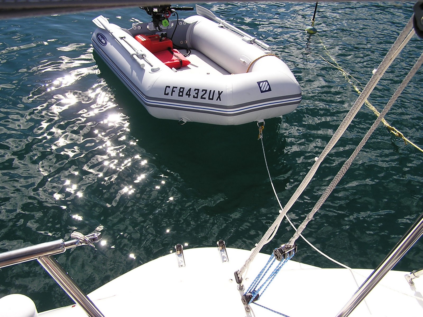
We had a fine sail home on Sunday, and for the first time I was able to observe the new transom extension under sail. It worked as I had hoped, reducing turbulence and drag, and increasing our sailing performance. But most of all, it made a perfect place to board the boat from the dinghy.
????
????
Read More..
 |
| Viewed from aft, the transom extension is hardly visible |
 |
| On the mooring with the swim ladder deployed |
 |
| Nice, clean wake |
????
 |
| The autopilot does the driving while Catalina recedes in the Honcho's wake. |
Monday, 25 October 2010
The Pace Slows
It's been about six weeks since I started working full time on preparing the Honcho for extended cruising in Mexico. Until yesterday it's been long days and nights of work to get the boat set up and prepared. Today I can say that we're basically ready to go. All that's left is final provisions and fuel. For the first time I could sit back and relax a bit. With my workload tapering off I've had time for a morning jog on the beach the last few days, and time to reflect more on the voyage instead of the multitude of tasks to be completed before I could say the boat and crew are ready. But now the days are getting shorter and the nights colder, telling me it's time to go.
Our course south will take us first to Ensenada where we'll clear customs and collect all the necessary permits for a vessel traveling in Mexican waters. This will take a couple of days. Then the Honcho will leave the cities behind and head south along the coast of the Baja Peninsula. Our first landfall will be Bahia San Bartolome, or Turtle Bay, about 300 miles from Ensenada. We'll spend a couple of days there, then continue on to Bahia Santa Maria, another 225 miles south. Bahia Santa Maria lies at roughly 25 degrees north latitude, and it is at this point where the weather usually turns from colder north Pacific conditions to warmer, more tropical conditions. In spite of the tropical latitude, the landscape there, as nearly everywhere else on the peninsula is arid and desert-like. We'll hang out in Bahia Santa Maria for a few days, then continue south past Cabo San Lucas, at the tip of the peninsula. Cabo lies about 175 miles south of Bahia Santa Maria and in addition to being a tourist destination, is the point where we'll leave the Baja Peninsula and cross the Sea of Cortez, making landfall at Puerto Vallarta. PV is about 300 miles southeast of Cabo San Lucas. That will conclude the first leg of the voyage.
Read More..
Our course south will take us first to Ensenada where we'll clear customs and collect all the necessary permits for a vessel traveling in Mexican waters. This will take a couple of days. Then the Honcho will leave the cities behind and head south along the coast of the Baja Peninsula. Our first landfall will be Bahia San Bartolome, or Turtle Bay, about 300 miles from Ensenada. We'll spend a couple of days there, then continue on to Bahia Santa Maria, another 225 miles south. Bahia Santa Maria lies at roughly 25 degrees north latitude, and it is at this point where the weather usually turns from colder north Pacific conditions to warmer, more tropical conditions. In spite of the tropical latitude, the landscape there, as nearly everywhere else on the peninsula is arid and desert-like. We'll hang out in Bahia Santa Maria for a few days, then continue south past Cabo San Lucas, at the tip of the peninsula. Cabo lies about 175 miles south of Bahia Santa Maria and in addition to being a tourist destination, is the point where we'll leave the Baja Peninsula and cross the Sea of Cortez, making landfall at Puerto Vallarta. PV is about 300 miles southeast of Cabo San Lucas. That will conclude the first leg of the voyage.
Saturday, 23 October 2010
Building the transom extension
Well, the transom extension is finished. It took longer to complete than I expected. This was due mostly to weather. Since starting the project we�ve seen weather records here in Long Beach matched or beaten in September and October. In late September we had a heat wave in which the temperature reached 111 degrees. Then in October everything changed and between the first and 23rd, we�ve had ten days of rain. This kind of weather is not conducive to doing fiberglass work outdoors. In spite of all that, the thing is done and the boat is just about ready to head south.

Okay, back to the process of building the extension. Step one was to take photos and dimensions of the existing transom geometry. This enabled me to develop the basic design and dimensions of the extension in the computer. Then I moved all the movable weight in the boat as far forward as possible to get the bow down and the stern up. This brought the bottom of the transom up a couple of inches�not nearly enough, so I put a couple of plastic trash barrels on the bow and filled them with water. This added another roughly 500 pounds on the bow, bringing it down a total of about seven inches. You would think that seven inches down in the bow would result in the stern going up a roughly equal distance. This is not the case on the Honcho. On this boat, the stern rises only about three and a half inches. The reason for this is that the longitudinal center of buoyancy, what you might call the flotational pivot point, of the boat is located aft of amidships. This is not so good for working on the transom while lying on the dock, but it helps the motion of the boat underway.

 |
| Before |
After getting the boat situated in the slip the real work began. I mocked up the basic shape of the extension with bits of wood, poster board and hotmelt glue to confirm the design. Using the mockup, I made a few minor changes to the CAD file and then produced working drawings of the mold that I would build onto the transom. This, and all subsequent work was done either lying or sitting on the dock and working on a part that was six or eight inches below that level.
With the mold in place I glassed in the lower part of the extension, which would be a faired extension of the hull bottom. If I was doing this in the comfort of a shop I would have vacuum infused all the glass parts, but on a boat floating in a slip there was no way I�d be able to get a workable vacuum bag on it. So I did it the old fashioned way with a bucket, brush and roller. When this part was cured, it was time to build the upper deck of the extension. Using half inch marine plywood, I shaped a deck piece so it fitted perfectly onto the lower part. I applied a layer of chopped strand mat to the underside of it and tacked it in place with Duraglas. The next step was to apply layers of mat and cloth to the top and fair it to the transom. A couple of coats of gelcoat were sprayed on using a little Preval sprayer. Then I created a pattern for the nonskid and rolled on thickened gelcoat. The last step was to bolt on the boarding ladder and go out for a sail. Total cost for the extension, not counting the ladder was about $200 in materials and 40 hours of labor.
Subscribe to:
Posts (Atom)


.jpg)


